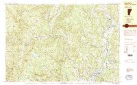
1984 Map of Newfane
USGS Topo · Published 1984About this map
The Connecticut River forms the eastern boundary of this mid-1980s landscape, winding through a region where agricultural meadows meet the steep terrain of the Green Mountains' eastern edge. The West River carves a deep valley through the center of the sheet, connecting settlements like West Dummerston and Williamsville Station. Local history is deeply etched into the topography at Newfane Hill, where the Newfane Hill Cem sits atop a prominence overlooking the modern village of Newfane.
Find a feature on this map
67 named features on this map. Tap any name to fly to it.
Don’t see what you’re looking for? This feature index may not catch every label — zoom into the map to look around manually.
Map Details
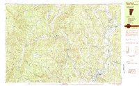
Editions of this 1984 Newfane Map
2 editions found
Other maps of this area

1889 · Wilmington
USGS Topo · 1:62,500

1891 · Wilmington
USGS Topo · 1:62,500

1891 · Brattleboro
USGS Topo · 1:62,500

1893 · Brattleboro
USGS Topo · 1:62,500

1894 · Londonderry
USGS Topo · 1:62,500

1898 · Keene
USGS Topo · 1:62,500

1899 · Londonderry
USGS Topo · 1:62,500

1899 · Wilmington
USGS Topo · 1:62,500

1927 · Bellows Falls
USGS Topo · 1:48,000

1930 · Saxtons River
USGS Topo · 1:48,000