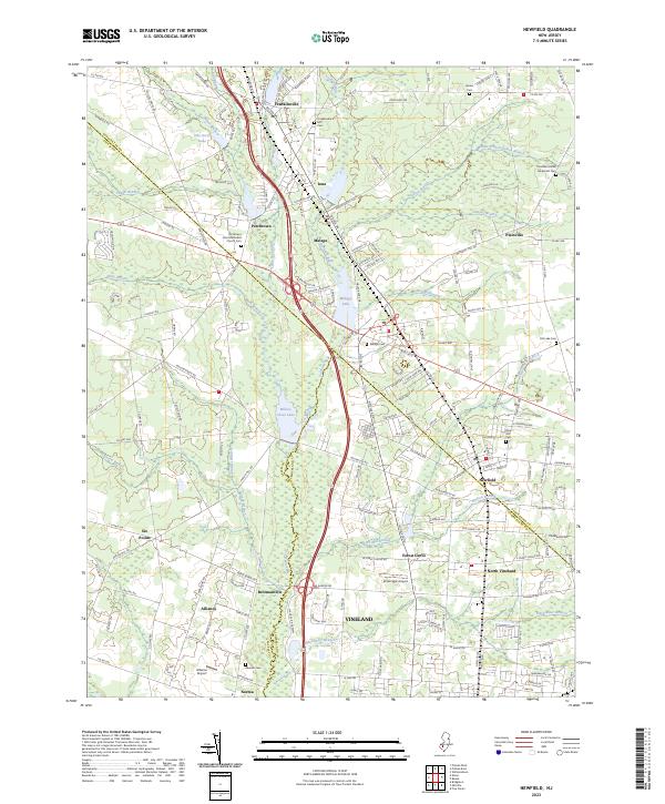
2023 Map of Newfield
USGS Topo · Published 2023About this map
The Maurice River serves as a defining natural corridor for this portion of southern New Jersey, winding through a landscape where the borders of Gloucester, Salem, and Cumberland counties converge. Small settlements like Franklinville, Malaga, and Newfield anchor the road network, reflecting a long history of local commerce and community life. The map reveals a dense distribution of family and community history sites, notably the Porchtown Zion Methodist Church,Cem and Alliance Cem.
Find a feature on this map
124 named features on this map. Tap any name to fly to it.
Don’t see what you’re looking for? This feature index may not catch every label — zoom into the map to look around manually.
Map Details
Editions of this 2023 Newfield Map
This is the sole edition of this map. No revisions or reprints were ever made.
Other maps of this area

1890 · Hammonton
USGS Topo · 1:62,500

1890 · Tuckahoe
USGS Topo · 1:62,500

1890 · Bridgeton
USGS Topo · 1:62,500

1890 · Glassboro
USGS Topo · 1:62,500

1893 · Tuckahoe
USGS Topo · 1:62,500

1894 · Hammonton
USGS Topo · 1:62,500

1894 · Bridgeton
USGS Topo · 1:62,500

1898 · Glassboro
USGS Topo · 1:62,500

1898 · Hammonton
USGS Topo · 1:62,500

1899 · Vineland
USGS Topo · 1:125,000
Featured Places
- Vineland, NJ
- Newfield, NJ
- Brotmanville, Pittsgrove Township
- Franklin Township, NJ
- Upper Pittsgrove Township, NJ