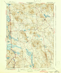
1937 Map of Newfield
USGS Topo · Published 1942About this map
Little Ossipee River and the Salmon Falls River define this borderland landscape between York County, Maine, and New Hampshire's Carroll and Strafford counties. The survey, based on field work from 1889 and 1933, illustrates a rural economy centered on mill settlements and small agricultural hubs like Ossipee Mills and Limerick. The distribution of farmsteads and schools across towns like Parsonsfield and Newfield reflects the early 20th-century settlement patterns of the Pine Tree State’s southwestern interior before modern highway developments shifted local commerce.
Find a feature on this map
69 named features on this map. Tap any name to fly to it.
Don’t see what you’re looking for? This feature index may not catch every label — zoom into the map to look around manually.
Map Details
Editions of this 1937 Newfield Map
3 editions found

Other maps of this area

1891 · Berwick
USGS Topo · 1:62,500

1891 · Kennebunk
USGS Topo · 1:62,500

1891 · Buxton
USGS Topo · 1:62,500

1891 · Newfield
USGS Topo · 1:62,500

1892 · Buxton
USGS Topo · 1:62,500

1893 · Kennebunk
USGS Topo · 1:62,500

1893 · Berwick
USGS Topo · 1:62,500

1893 · Buxton
USGS Topo · 1:62,500

1893 · Newfield
USGS Topo · 1:62,500

1896 · Sebago
USGS Topo · 1:62,500