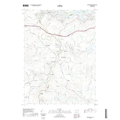
2019 Map of Newfoundland
USGS Topo · Published 2019About this map
Wallenpaupack Creek and its many branches define the geography of this Pocono Plateau region along the border of Wayne and Pike counties. The massive Lake Wallenpaupack dominates the northern edge, where Ledgedale and Cairns Island anchor a landscape shaped by water and recreation. Further south, the terrain is dotted with small, long-standing settlements like Newfoundland, Greentown, and Haags Mill, which follow the winding path of Mill Cr and Sugar Hill Cr. The distribution of local landmarks such as Zion Cem and the Pine Grove Cem near South Sterling provides a clear view of the area's social and community hubs. These pockets of settlement are connected by a network of rural routes and local roads, revealing how the population is concentrated within the valleys and along the lakefront, while the higher elevations like Carlton Hill remain less densely developed.
Find a feature on this map
158 named features on this map. Tap any name to fly to it.
Don’t see what you’re looking for? This feature index may not catch every label — zoom into the map to look around manually.
Map Details
Editions of this 2019 Newfoundland Map
This is the sole edition of this map. No revisions or reprints were ever made.
Other maps of this area

1919 · Pocono
USGS Topo · 1:62,500

1921 · Pocono
USGS Topo · 1:62,500

1923 · Pocono
USGS Topo · 1:62,500

1924 · Bushkill
USGS Topo · 1:48,000

1928 · Ariel
USGS Topo · 1:62,500

1932 · Ariel
USGS Topo · 1:62,500

1935 · Hawley
USGS Topo · 1:62,500

1938 · Hawley
USGS Topo · 1:62,500

1943 · Bushkill
USGS Topo · 1:62,500

1943 · Pocono
USGS Topo · 1:62,500