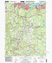
1999 Map of Newfoundland
USGS Topo · Published 2001About this map
The Wallenpaupack Creek watershed defines this corner of the Poconos, where the water flows northward toward the expansive Lake Wallenpaupack. Settled crossroads like Newfoundland and South Sterling are the primary hubs of the area, established along the various forks and runs that feed the main channel. The landscape is a mix of dense woodland protected within the Delaware State Forest and small residential clusters.
Find a feature on this map
46 named features on this map. Tap any name to fly to it.
Don’t see what you’re looking for? This feature index may not catch every label — zoom into the map to look around manually.
Map Details
Editions of this 1999 Newfoundland Map
This is the sole edition of this map. No revisions or reprints were ever made.
Other maps of this area

1919 · Pocono
USGS Topo · 1:62,500

1921 · Pocono
USGS Topo · 1:62,500

1923 · Pocono
USGS Topo · 1:62,500

1924 · Bushkill
USGS Topo · 1:48,000

1928 · Ariel
USGS Topo · 1:62,500

1932 · Ariel
USGS Topo · 1:62,500

1935 · Hawley
USGS Topo · 1:62,500

1938 · Hawley
USGS Topo · 1:62,500

1943 · Bushkill
USGS Topo · 1:62,500

1943 · Pocono
USGS Topo · 1:62,500
Featured Places
- Sterling Township, PA
- Greene Township, PA
- Dreher Township, PA
- Greentown, Greene Township
- Lake in the Clouds, Greene Township