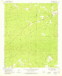
1969 Map of Newhope
USGS Topo · Published 1980About this map
Newhope and the surrounding timberlands of the Pike and Howard county line are defined by a network of creeks and ridge-top cemeteries in this 1969 study. The terrain transitions from the heights of Blue Ridge and Pine Mountain down to the fertile bottomlands along the Muddy Fork. A quiet landscape of rural industry is visible in the numerous Gravel Pits and a Shale Pit, while the agricultural history of the region is etched into the landscape via an Old Railroad Grade and named routes like Janes Ford Road. Genealogists will find several burial sites including Harmony Cem, Liberty Cem, and Kesterson Cem, many of which sit near country houses of worship like Pleasant Grove Ch and Antioch Ch. Unusual local landmarks like the Minnow Ponds and the Water Can Crossing on Killian Creek provide unique geographic markers of the era.
Find a feature on this map
51 named features on this map. Tap any name to fly to it.
Don’t see what you’re looking for? This feature index may not catch every label — zoom into the map to look around manually.
Map Details
Editions of this 1969 Newhope Map
2 editions found
Other maps of this area

1906 · Caddo Gap
USGS Topo · 1:125,000

1913 · De Queen
USGS Topo · 1:125,000

1936 · Athens
USGS Topo · 1:48,000

1942 · Athens
USGS Topo · 1:62,500

1950 · Mcalester
USGS Topo · 1:250,000

1955 · Little Rock
USGS Topo · 1:250,000

1956 · Little Rock
USGS Topo · 1:250,000

1959 · Umpire
USGS Topo · 1:62,500

1960 · Little Rock
USGS Topo · 1:250,000

1962 · McAlester
USGS Topo · 1:250,000