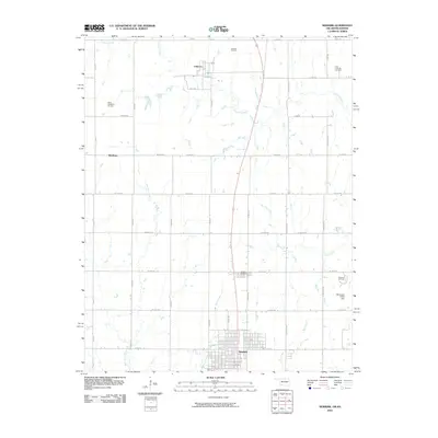
2010 Map of Newkirk
USGS Topo · Published 2010About this map
Newkirk serves as the primary hub of this Kay County landscape, situated near the southern edge of the survey where a grid of residential streets centers around E 7th St. The area's economic history is defined by extensive energy development, with the Chilocco Oil Field, North Middleton Oil Field, and East Chilocco Oil Field scattered across the plains toward the Kansas border. In the north, the settlement of Chilocco sits near the winding course of Chilocco Creek, while the rural landscape to the west is anchored by Middleton. Significant drainage systems including Bois d'Arc Creek and Spring Creek cut through the section lines, shaping the agricultural layout. Genealogists will find the Newkirk Cemetery clearly marked along E Fork Rd, providing a vital link to the families who established these prairie communities and worked the surrounding oil fields.
Find a feature on this map
31 named features on this map. Tap any name to fly to it.
Don’t see what you’re looking for? This feature index may not catch every label — zoom into the map to look around manually.
Map Details
Editions of this 2010 Newkirk Map
This is the sole edition of this map. No revisions or reprints were ever made.
Other maps of this area

1889 · Burden
USGS Topo · 1:125,000

1890 · Wellington
USGS Topo · 1:125,000

1935 · Kaw
USGS Topo · 1:62,500

1955 · Wichita
USGS Topo · 1:250,000

1955 · Enid
USGS Topo · 1:250,000

1958 · Enid
USGS Topo · 1:250,000

1958 · Wichita
USGS Topo · 1:250,000

1963 · Uncas
USGS Topo · 1:24,000

1963 · Kaw City NW
USGS Topo · 1:24,000

1965 · Silverdale
USGS Topo · 1:24,000