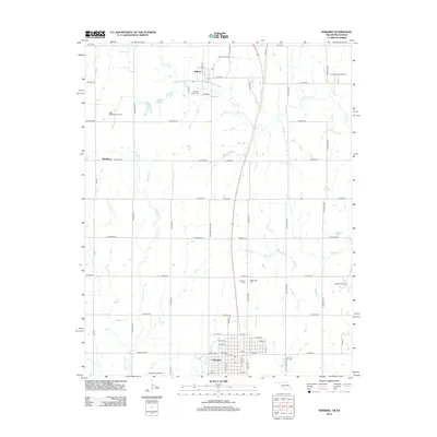
2012 Map of Newkirk
USGS Topo · Published 2012About this map
Newkirk serves as the focal point of this northern Oklahoma landscape, situated just south of the Kansas border where the plains are etched by the winding paths of Chilocco Cr and Bois d'Arc Cr. The northern reaches of the quadrangle are dominated by the historic grounds of Chilocco, notable for the Chilocco Indian Cem and a dense network of local roads like W Indian Rd. The map reveals a region defined by agricultural heritage and a long history of energy extraction, evidenced by the Chilocco Oil Field, North Middleton Oil Field, and Newkirk Oil Field scattered across the township. Further south, the town of Newkirk is laid out in a precise grid including W 1st St and Kaw Dr, while smaller community landmarks like Washunga Cem and the Grass Root Airport provide specific points of interest for genealogists and local historians.
Find a feature on this map
63 named features on this map. Tap any name to fly to it.
Don’t see what you’re looking for? This feature index may not catch every label — zoom into the map to look around manually.
Map Details
Editions of this 2012 Newkirk Map
This is the sole edition of this map. No revisions or reprints were ever made.
Other maps of this area

1889 · Burden
USGS Topo · 1:125,000

1890 · Wellington
USGS Topo · 1:125,000

1935 · Kaw
USGS Topo · 1:62,500

1955 · Wichita
USGS Topo · 1:250,000

1955 · Enid
USGS Topo · 1:250,000

1958 · Enid
USGS Topo · 1:250,000

1958 · Wichita
USGS Topo · 1:250,000

1963 · Uncas
USGS Topo · 1:24,000

1963 · Kaw City NW
USGS Topo · 1:24,000

1965 · Silverdale
USGS Topo · 1:24,000