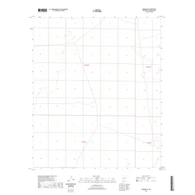
2020 Map of Newman NE
USGS Topo · Published 2020About this map
Arid basin landscapes and survey boundaries dominate this portion of Otero County, as captured in this 2020 United States Geological Survey record. The area is defined by the intersection of four primary township and range blocks: T24s R6e, T24s R7e, T25s R6e, and T25s R7e. While the map lacks named settlements or developed infrastructure, it provides a precise visualization of the public land survey system grid across this desert terrain. Topographic contours illustrate the subtle elevations of the New Mexico landscape, offering a clear view of the natural drainage patterns and land divisions within the Newman NE quadrangle. This documentation is primarily useful for understanding contemporary land management boundaries and the physical geography of the region.
Find a feature on this map
4 named features on this map. Tap any name to fly to it.
Don’t see what you’re looking for? This feature index may not catch every label — zoom into the map to look around manually.
Map Details
Editions of this 2020 Newman NE Map
This is the sole edition of this map. No revisions or reprints were ever made.
Other maps of this area

1940 · Orogrande
USGS Topo · 1:62,500

1940 · Newman
USGS Topo · 1:62,500

1941 · Desert
USGS Topo · 1:62,500

1943 · Parker Lake
USGS Topo · 1:62,500

1943 · Desert
USGS Topo · 1:62,500

1943 · Newman
USGS Topo · 1:62,500

1943 · Orogrande
USGS Topo · 1:62,500

1948 · Davies Tank
USGS Topo · 1:24,000

1948 · El Wood
USGS Topo · 1:24,000

1948 · Newman NW
USGS Topo · 1:24,000