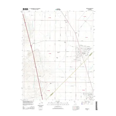
2015 Map of Newman
USGS Topo · Published 2015About this map
The Newman settlement and the northern edge of Gustine anchor this mid-2010s study of the western San Joaquin Valley. This landscape is defined by the massive infrastructure of California water management, where the Governor Edmund G Brown California Aqueduct and the Delta-Mendota Canal run parallel along the base of the western hills. These artificial rivers contrast with the seasonal drainage of Orestimba Cr and the Newman Waste-Way.
Find a feature on this map
92 named features on this map. Tap any name to fly to it.
Don’t see what you’re looking for? This feature index may not catch every label — zoom into the map to look around manually.
Map Details
Editions of this 2015 Newman Map
This is the sole edition of this map. No revisions or reprints were ever made.
Other maps of this area

1916 · Mitchell School
USGS Topo · 1:31,680

1916 · Crows Landing
USGS Topo · 1:31,680

1916 · Patterson
USGS Topo · 1:31,680

1917 · Newman
USGS Topo · 1:31,680

1918 · Gustine
USGS Topo · 1:31,680

1919 · Orestimba
USGS Topo · 1:62,500

1919 · Orestimba Creek
USGS Topo · 1:31,680

1919 · Ingomar
USGS Topo · 1:31,680

1920 · Pacheco Pass
USGS Topo · 1:62,500

1922 · Howard Ranch
USGS Topo · 1:31,680