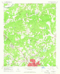
1965 Map of Newnan North
USGS Topo · Published 1966About this map
The Chattahoochee River marks the northwestern corner of this mid-1960s landscape, where rural communities like Roscoe and Sargent sit amidst a network of creeks and small lakes. In the southern half of the map, the city of Newnan expands northward, featuring established landmarks such as the Elm Street Sch, Newnan Jr High Sch, and the Ymca. The transition from the urban core to the surrounding countryside is evident in the development of neighborhoods like Sherwood Forest and Windsor Estates, while the Central Of Georgia railroad line cuts through the terrain, connecting industrial sites such as Arneo Mills. Notable local gathering spots and institutions include the Newnan Country Club, a Drive-in Theater, and the County Hospital. Further out, the map details numerous small family and community landmarks, from the Dunaway Gardens to rural worship centers like Andrew Chapel and Jones Chapel Cem.
Find a feature on this map
71 named features on this map. Tap any name to fly to it.
Don’t see what you’re looking for? This feature index may not catch every label — zoom into the map to look around manually.
Map Details
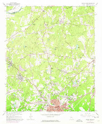
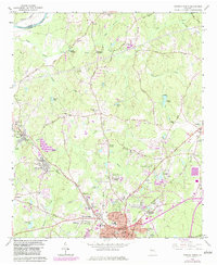
Editions of this 1965 Newnan North Map
3 editions found
Other maps of this area

1891 · Marietta
USGS Topo · 1:125,000

1895 · Marietta
USGS Topo · 1:125,000

1897 · Marietta
USGS Topo · 1:125,000

1901 · Marietta
USGS Topo · 1:125,000

1953 · Atlanta
USGS Topo · 1:250,000

1954 · Palmetto
USGS Topo · 1:24,000

1957 · Atlanta
USGS Topo · 1:250,000

1958 · Rico
USGS Topo · 1:24,000

1958 · Atlanta
USGS Topo · 1:250,000
1958 · Villa Rica
USGS Topo · 1:62,500