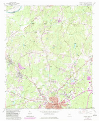
1965 Map of Newnan North
USGS Topo · Published 1983About this map
Newnan expands northward during the mid-1960s, showing a landscape where residential growth begins to meet the established industrial and agricultural roots of Coweta County. The Central of Georgia and Atlanta and West Point railroads anchor the local economy, passing through manufacturing centers like Arco Mills and the community of Sargent. Historic rural life is evidenced by numerous country churches and cemeteries, such as Andrews Chapel and Oak Grove Ch, which dot the terrain alongside more modern developments like Windsor Estates and Sherwood Forest. Along the western edge, the Chattahoochee River defines the county boundary, while interior waterways like Wahoo Creek and Cedar Creek are punctuated by landmarks such as Sewell Millpond and Dunaway Gardens. This survey captures the transition from a rail-dependent textile and farming region to a suburbanizing extension of the Atlanta corridor.
Find a feature on this map
85 named features on this map. Tap any name to fly to it.
Don’t see what you’re looking for? This feature index may not catch every label — zoom into the map to look around manually.
Map Details
Editions of this 1965 Newnan North Map
3 editions found
Other maps of this area

1891 · Marietta
USGS Topo · 1:125,000

1895 · Marietta
USGS Topo · 1:125,000

1897 · Marietta
USGS Topo · 1:125,000

1901 · Marietta
USGS Topo · 1:125,000

1953 · Atlanta
USGS Topo · 1:250,000

1954 · Palmetto
USGS Topo · 1:24,000

1957 · Atlanta
USGS Topo · 1:250,000

1958 · Rico
USGS Topo · 1:24,000

1958 · Atlanta
USGS Topo · 1:250,000
1958 · Villa Rica
USGS Topo · 1:62,500