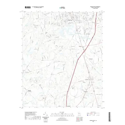
2020 Map of Newnan South
USGS Topo · Published 2020About this map
Newnan serves as the focal point of this 2020 Coweta County survey, where urban infrastructure meets the traditional cemetery landscapes of Georgia. The map documents a dense network of family and community burial grounds, including the Allen Family Cem, Evergreen Cem, and Samuel Meadows Cem, providing a detailed record for genealogists. The industrial character of the southern district is anchored by the Newnan South Industrial Dr and the Newnan Coweta County Airport, illustrating the modern economic footprint of the region.
Find a feature on this map
183 named features on this map. Tap any name to fly to it.
Don’t see what you’re looking for? This feature index may not catch every label — zoom into the map to look around manually.
Map Details
Editions of this 2020 Newnan South Map
This is the sole edition of this map. No revisions or reprints were ever made.
Other maps of this area

1953 · Atlanta
USGS Topo · 1:250,000

1957 · Atlanta
USGS Topo · 1:250,000

1958 · Atlanta
USGS Topo · 1:250,000

1964 · Hogansville
USGS Topo · 1:24,000

1964 · Grantville
USGS Topo · 1:24,000

1965 · Newnan South
USGS Topo · 1:24,000
1965 · Newnan North
USGS Topo · 1:24,000
1965 · Newnan SW
USGS Topo · 1:24,000
1965 · Whitesburg
USGS Topo · 1:24,000

1965 · Madras
USGS Topo · 1:24,000