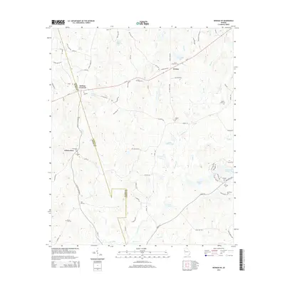
2014 Map of Newnan SW
USGS Topo · Published 2014About this map
Stallings Crossroad serves as a central landmark in this portion of the Georgia Piedmont, where the boundary between Heard and Coweta counties dictates the local geography. The area is characterized by a high concentration of community burial grounds and small rural hubs like Dresden and Wilsons Store. These features suggest a long-established pattern of small-scale agriculture and tight-knit rural settlements that persist into the modern era.
Find a feature on this map
93 named features on this map. Tap any name to fly to it.
Don’t see what you’re looking for? This feature index may not catch every label — zoom into the map to look around manually.
Map Details
Editions of this 2014 Newnan SW Map
This is the sole edition of this map. No revisions or reprints were ever made.
Other maps of this area

1899 · Wedowee
USGS Topo · 1:125,000

1902 · Wedowee
USGS Topo · 1:125,000

1953 · Atlanta
USGS Topo · 1:250,000

1957 · Atlanta
USGS Topo · 1:250,000

1958 · Atlanta
USGS Topo · 1:250,000

1964 · Hogansville
USGS Topo · 1:24,000

1964 · Hillcrest
USGS Topo · 1:24,000

1964 · Grantville
USGS Topo · 1:24,000
1964 · Franklin
USGS Topo · 1:24,000
1964 · Lowell
USGS Topo · 1:24,000