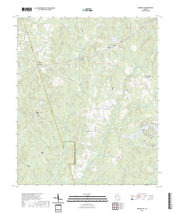
2024 Map of Newnan SW
USGS Topo · Published 2024About this map
Stallings Crossroad and Dresden anchor this rural landscape along the boundary of Coweta and Heard counties. The map reflects a deeply rooted community structure, evidenced by the high density of family and church-affiliated burial grounds such as Stallings Cem, Ware Cem, and the Darden-Crain Cem. Many of these sites, including the Dent Chapel African Methodist Episcopal Church Cem and Wesley Chapel United Methodist Church Cem, suggest the enduring significance of these congregations in the local genealogy and settlement history of western Georgia.
Find a feature on this map
83 named features on this map. Tap any name to fly to it.
Don’t see what you’re looking for? This feature index may not catch every label — zoom into the map to look around manually.
Map Details
Editions of this 2024 Newnan SW Map
This is the sole edition of this map. No revisions or reprints were ever made.
Other maps of this area

1899 · Wedowee
USGS Topo · 1:125,000

1902 · Wedowee
USGS Topo · 1:125,000

1953 · Atlanta
USGS Topo · 1:250,000

1957 · Atlanta
USGS Topo · 1:250,000

1958 · Atlanta
USGS Topo · 1:250,000

1964 · Hogansville
USGS Topo · 1:24,000

1964 · Hillcrest
USGS Topo · 1:24,000

1964 · Grantville
USGS Topo · 1:24,000
1964 · Franklin
USGS Topo · 1:24,000
1964 · Lowell
USGS Topo · 1:24,000