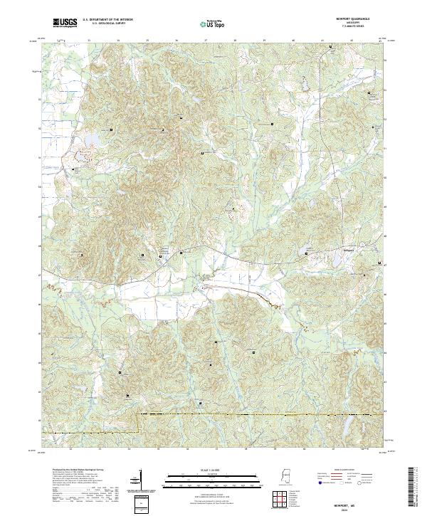
2024 Map of Newport
USGS Topo · Published 2024About this map
Seneasha Creek meanders through this portion of central Mississippi, defining a landscape marked by deep-rooted family and community ties. The settlement of Newport serves as a local hub near the crossing of Seneasha Creek and Horton Creek, surrounded by a high density of rural cemeteries and churches that speak to the area’s genealogical depth. Numerous family-named sites, such as the Johnson Family Cem and Ables Cem, are scattered across the terrain, suggesting a history of small-scale agriculture and established homesteads.
Find a feature on this map
85 named features on this map. Tap any name to fly to it.
Don’t see what you’re looking for? This feature index may not catch every label — zoom into the map to look around manually.
Map Details
Editions of this 2024 Newport Map
This is the sole edition of this map. No revisions or reprints were ever made.
Other maps of this area

1953 · Meridian
USGS Topo · 1:250,000

1953 · West Point
USGS Topo · 1:250,000

1957 · Meridian
USGS Topo · 1:250,000

1958 · West Point
USGS Topo · 1:250,000

1962 · Thomastown
USGS Topo · 1:62,500

1963 · West Point
USGS Topo · 1:250,000

1964 · Camden
USGS Topo · 1:24,000

1964 · Newport
USGS Topo · 1:24,000
1964 · Durant
USGS Topo · 1:24,000
1964 · Owens Wells
USGS Topo · 1:24,000