2015 Map of Newport Beach OE S
USGS Topo · Published 2015About this map
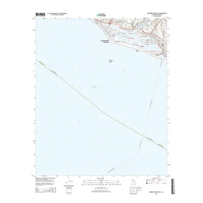
The coastal developments of Newport Beach and Balboa are meticulously detailed in this survey, showcasing a landscape of intricate waterways and dense residential planning. The map highlights the specialized geography of Lido Peninsula and the surrounding West Lido Channel, as well as the transition into the Lower Newport Bay. Notable local landmarks like South Coast College and North Star Beach appear alongside the residential streets of Corona del Mar. Beyond the shoreline, the map reveals the underwater topography of the Newport Submarine Canyon dropping off into the Pacific Ocean. This 2015 edition provides a modern record of the harbor's configuration, from the piers at Balboa Beach to the secluded China Cove Beach, documenting the high-density coastal infrastructure and leisure-focused geography of the Orange County coast.
Find a feature on this map
71 named features on this map. Tap any name to fly to it.
Don’t see what you’re looking for? This feature index may not catch every label — zoom into the map to look around manually.
Map Details
Editions of this 2015 Newport Beach OE S Map
This is the sole edition of this map. No revisions or reprints were ever made.
Other maps of this area

1896 · Santa Ana
USGS Topo · 1:62,500

1896 · Las Bolsas
USGS Topo · 1:62,500

1901 · Southern California Sheet No. 1
USGS Topo · 1:250,000

1901 · Santa Ana
USGS Topo · 1:62,500

1902 · Capistrano
USGS Topo · 1:125,000

1902 · Corona
USGS Topo · 1:125,000

1904 · Southern California Sheet No. 1
USGS Topo · 1:250,000

1906 · Capistrano
USGS Topo · 1:125,000

1932 · Newport Beach
USGS Topo · 1:31,680

1932 · Tustin
USGS Topo · 1:31,680
Featured Places
- Huntington Beach, CA
- Newport Beach, CA
- Newport Heights, Newport Beach
- Harbor Island, Newport Beach
- Irvine Terrace, Newport Beach