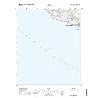
2018 Map of Newport Beach OE S
USGS Topo · Published 2018About this map
Lower Newport Bay serves as the focal point of this coastal landscape, illustrating the intricate shoreline development along the Pacific Ocean. The map provides a detailed view of the area's residential and recreational geography, highlighting the distinct island communities of Balboa Island and the smaller Collins Island. The land-water interface is defined by the Newport Channel and several named stretches of sand, including North Star Beach and the sheltered China Cove Beach. On the mainland, the established neighborhoods of Balboa, Newport Beach, and Corona del Mar are shown with a dense network of streets like W Balboa Blvd and Newport Blvd. The map's layout emphasizes the unique maritime character of this region, where urban infrastructure closely follows the contours of the bay and the open ocean front.
Find a feature on this map
73 named features on this map. Tap any name to fly to it.
Don’t see what you’re looking for? This feature index may not catch every label — zoom into the map to look around manually.
Map Details
Editions of this 2018 Newport Beach OE S Map
This is the sole edition of this map. No revisions or reprints were ever made.
Other maps of this area

1896 · Santa Ana
USGS Topo · 1:62,500

1896 · Las Bolsas
USGS Topo · 1:62,500

1901 · Southern California Sheet No. 1
USGS Topo · 1:250,000

1901 · Santa Ana
USGS Topo · 1:62,500

1902 · Capistrano
USGS Topo · 1:125,000

1902 · Corona
USGS Topo · 1:125,000

1904 · Southern California Sheet No. 1
USGS Topo · 1:250,000

1906 · Capistrano
USGS Topo · 1:125,000

1932 · Newport Beach
USGS Topo · 1:31,680

1932 · Tustin
USGS Topo · 1:31,680
Featured Places
- Huntington Beach, CA
- Newport Beach, CA
- Newport Heights, Newport Beach
- Harbor Island, Newport Beach
- Irvine Terrace, Newport Beach