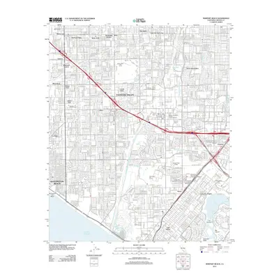
2012 Map of Newport Beach
USGS Topo · Published 2012About this map
Fountain Valley and the surrounding coastal plain of Orange County are defined here by a complex web of drainage channels and arterial freeways in the early 21st century. The landscape is intensely subdivided into neighborhoods such as Kensington Gardens, Colonia Juarez, and Del Prado Bolsa, reflecting decades of suburban expansion. The Santa Ana River serves as a primary geographic boundary, while smaller waterways like the Talbert Channel and Paularino Channel weave through the residential and industrial grids.
Find a feature on this map
52 named features on this map. Tap any name to fly to it.
Don’t see what you’re looking for? This feature index may not catch every label — zoom into the map to look around manually.
Map Details
Editions of this 2012 Newport Beach Map
This is the sole edition of this map. No revisions or reprints were ever made.
Other maps of this area

1896 · Santa Ana
USGS Topo · 1:62,500

1896 · Anaheim
USGS Topo · 1:62,500

1896 · Las Bolsas
USGS Topo · 1:62,500

1896 · Downey
USGS Topo · 1:62,500

1898 · Anaheim
USGS Topo · 1:62,500

1899 · Downey
USGS Topo · 1:62,500

1901 · Southern California Sheet No. 1
USGS Topo · 1:250,000

1901 · Santa Ana
USGS Topo · 1:62,500

1901 · Anaheim
USGS Topo · 1:62,500

1902 · Downey
USGS Topo · 1:62,500