1921 Map of Newport News
USGS Topo · Published 1921About this map
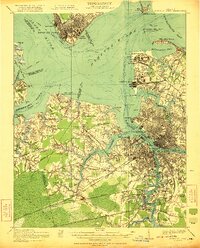
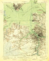
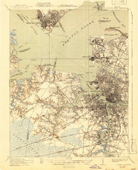
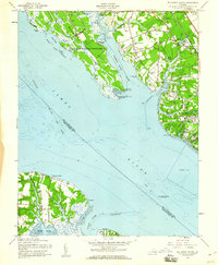
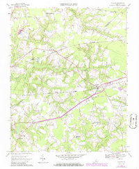
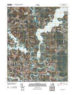
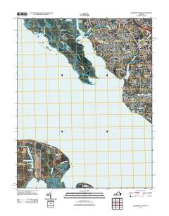
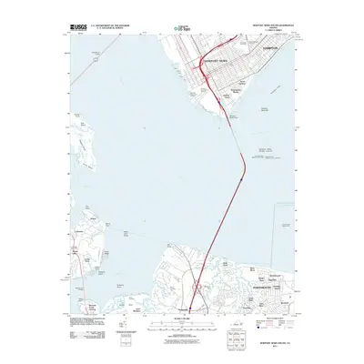
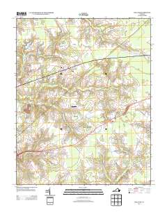
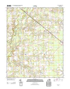
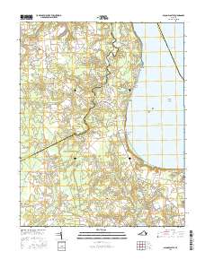
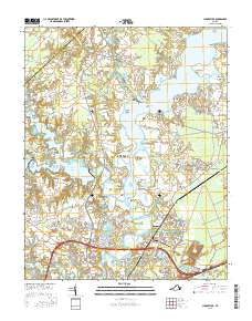
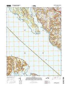
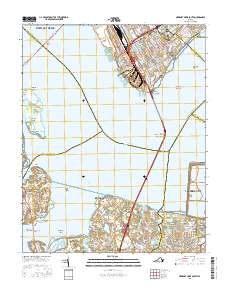
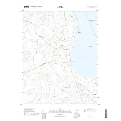
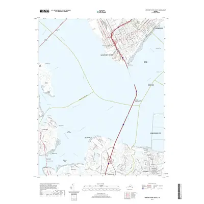
Hampton Roads serves as the central focal point for this survey, illustrating the intensive military and maritime development that defined the region following the Great War. The map details a landscape transition from the urban centers of Newport News, Norfolk, and Portsmouth to the industrial and naval installations that ring the harbor, including the Navy Base, Army Base, and the Navy Yard. The strategic geography of the era is evident in the layout of the Pig Point Ordnance Depot and Camp Stuart, while several Steamboat Routes crisscross the waters of the James River and Chesapeake Bay. Beyond the city grids and shipyards, the landscape softens into the rural fringes of the Dismal Swamp and scattered communities like Churchland, where the Jolliff School and local Cem markers provide vital touchstones for family historians researching the South Hampton Roads area during this period of rapid expansion.
Find a feature on this map
101 named features on this map. Tap any name to fly to it.
Don’t see what you’re looking for? This feature index may not catch every label — zoom into the map to look around manually.
Map Details
Editions of this 1921 Newport News Map
4 editions found

Historical Maps of Norfolk Through Time
57 maps found
1921 Newport News
Isle of Wight County, VA

1944 Raynor
Isle of Wight County, VA

1944 Zuni
Isle of Wight County, VA

1945 Raynor
Isle of Wight County, VA

1945 Zuni
Isle of Wight County, VA

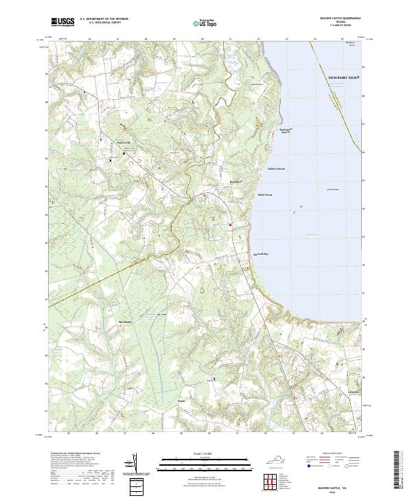
1948 Bacons Castle
Isle of Wight County, VA

1949 Chuckatuck
Isle of Wight County, VA

1950 Blackstone
Isle of Wight County, VA

1950 Mulberry Island
Isle of Wight County, VA

1951 Blackstone
Isle of Wight County, VA

1952 Newport News
Isle of Wight County, VA

1955 Newport News
Isle of Wight County, VA
1957 Bacons Castle
Isle of Wight County, VA
1957 Mulberry Island
Isle of Wight County, VA
1964 Newport News South
Isle of Wight County, VA
1965 Chuckatuck
Isle of Wight County, VA
1965 Mulberry Island
Isle of Wight County, VA
1967 Holland
Isle of Wight County, VA

1968 Raynor
Isle of Wight County, VA
1969 Bacons Castle
Isle of Wight County, VA
1969 Zuni
Isle of Wight County, VA

1994 Newport News South
Isle of Wight County, VA
2010 Bacons Castle
Isle of Wight County, VA
2010 Chuckatuck
Isle of Wight County, VA
2010 Holland
Isle of Wight County, VA
2010 Raynor
Isle of Wight County, VA
2010 Zuni
Isle of Wight County, VA
2011 Mulberry Island
Isle of Wight County, VA
2011 Newport News South
Isle of Wight County, VA
2013 Bacons Castle
Isle of Wight County, VA
2013 Chuckatuck
Isle of Wight County, VA
2013 Holland
Isle of Wight County, VA
2013 Mulberry Island
Isle of Wight County, VA
2013 Newport News South
Isle of Wight County, VA
2013 Raynor
Isle of Wight County, VA
2013 Zuni
Isle of Wight County, VA
2016 Bacons Castle
Isle of Wight County, VA
2016 Chuckatuck
Isle of Wight County, VA
2016 Holland
Isle of Wight County, VA
2016 Mulberry Island
Isle of Wight County, VA
2016 Newport News South
Isle of Wight County, VA
2016 Raynor
Isle of Wight County, VA
2016 Zuni
Isle of Wight County, VA
2019 Bacons Castle
Isle of Wight County, VA
2019 Chuckatuck
Isle of Wight County, VA
2019 Holland
Isle of Wight County, VA
2019 Mulberry Island
Isle of Wight County, VA
2019 Newport News South
Isle of Wight County, VA
2019 Raynor
Isle of Wight County, VA
2019 Zuni
Isle of Wight County, VA
2022 Bacons Castle
Isle of Wight County, VA
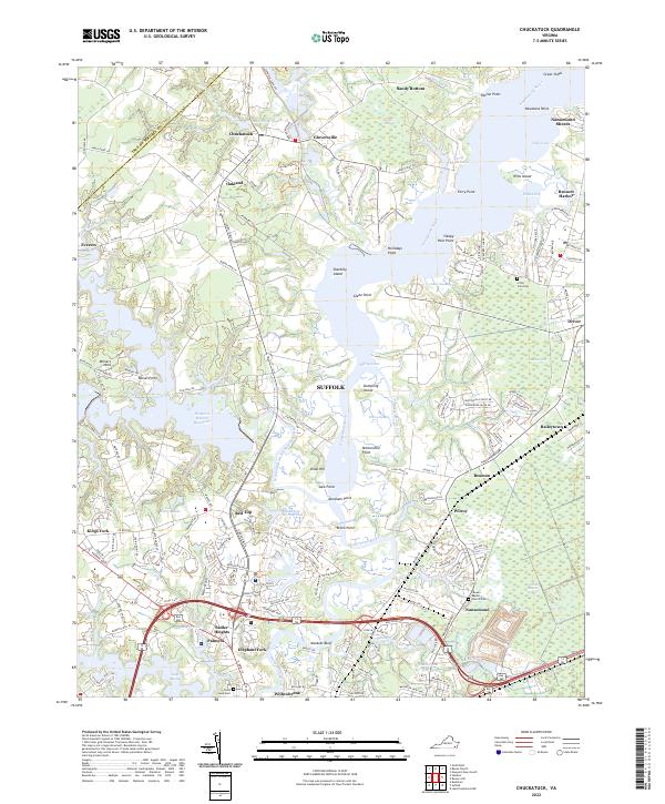
2022 Chuckatuck
Isle of Wight County, VA
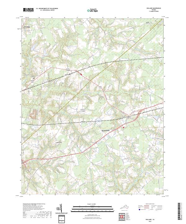
2022 Holland
Isle of Wight County, VA
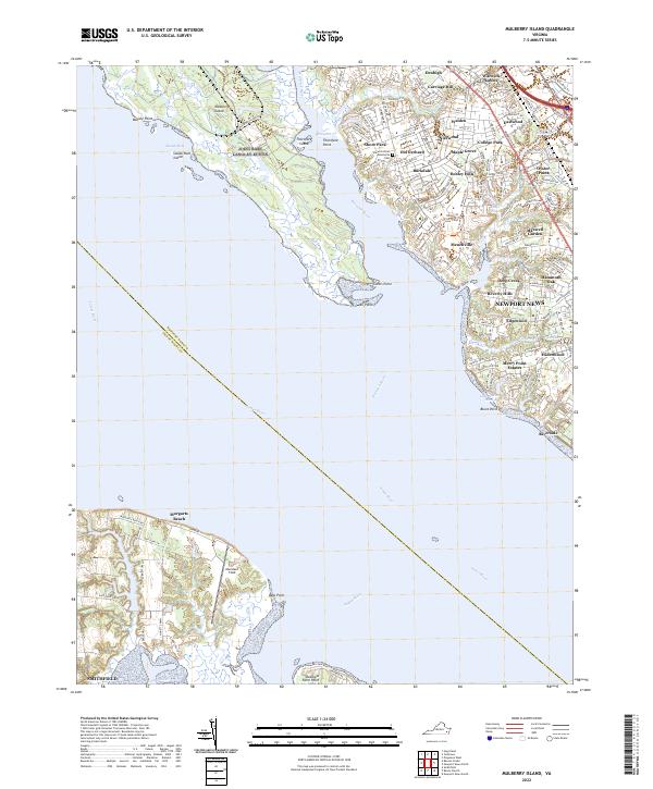
2022 Mulberry Island
Isle of Wight County, VA
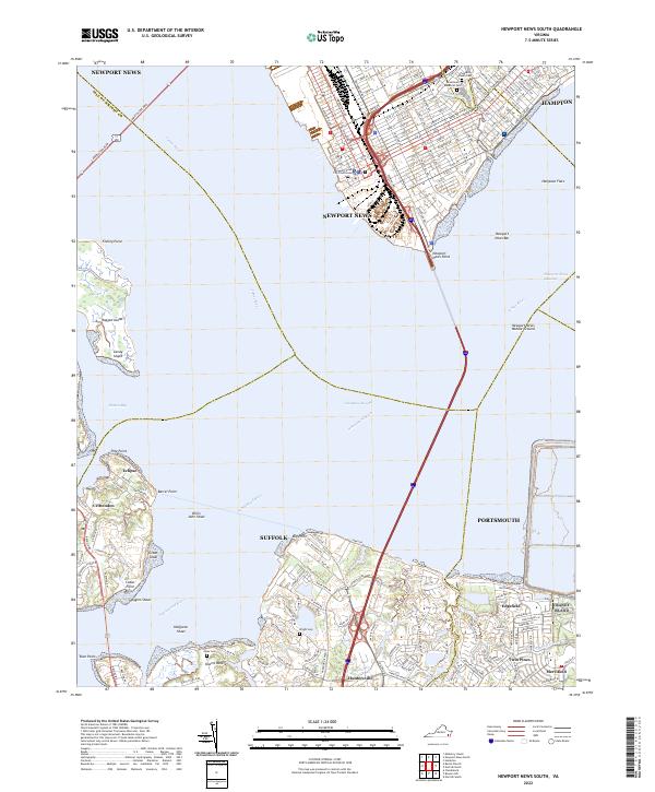
2022 Newport News South
Isle of Wight County, VA
2022 Raynor
Isle of Wight County, VA

2022 Zuni
Isle of Wight County, VA