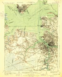
1921 Map of Newport News
USGS Topo · Published 1928About this map
Military and maritime infrastructure dominates the landscape of Hampton Roads in this early post-war period. The massive Ship Yard at Newport News and the Navy Yard in Portsmouth anchor the regional economy, while the sprawling Navy Base at Sewall Point and the Army Base to its south reflect the rapid expansion of naval operations. The map provides a detailed view of the complex rail networks serving these hubs, including the Chesapeake and Ohio RR and Virginian RR, which converge on the waterfront piers.
Find a feature on this map
121 named features on this map. Tap any name to fly to it.
Don’t see what you’re looking for? This feature index may not catch every label — zoom into the map to look around manually.
Map Details
Editions of this 1921 Newport News Map
4 editions found
Other maps of this area

1907 · Norfolk
USGS Topo · 1:125,000

1907 · Yorktown
USGS Topo · 1:62,500

1907 · Hampton
USGS Topo · 1:62,500

1918 · Cape Henry
USGS Topo · 1:62,500

1919 · Smithfield
USGS Topo · 1:62,500

1919 · Suffolk
USGS Topo · 1:62,500

1919 · Cape Henry
USGS Topo · 1:62,500

1921 · Newport News
USGS Topo · 1:62,500

1939 · Moyock
USGS Topo · 1:62,500

1940 · Lake Drummond
USGS Topo · 1:62,500