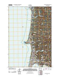
2011 Map of Newport North
USGS Topo · Published 2011About this map
Newport and its coastal surroundings are documented here in a detailed snapshot of the Central Oregon Coast. The map tracks the Pacific shoreline from the geologic formations at Devils Punchbowl Arch and the Otter Rock Post Office southward through a series of residential and recreational developments. These include Beverly Beach, Moolack Beach, and Agate Beach, illustrating the 21st-century density of the region. Inland, the landscape is defined by the Newport Reservoir and numerous coastal streams like Big Creek and Jeffries Creek.
Find a feature on this map
68 named features on this map. Tap any name to fly to it.
Don’t see what you’re looking for? This feature index may not catch every label — zoom into the map to look around manually.
Map Details
Editions of this 2011 Newport North Map
This is the sole edition of this map. No revisions or reprints were ever made.
Other maps of this area

1941 · Cape Foulweather
USGS Topo · 1:62,500

1942 · Euchre Mtn
USGS Topo · 1:62,500

1942 · Yaquina
USGS Topo · 1:62,500

1942 · Toledo
USGS Topo · 1:62,500

1943 · Euchre Mtn
USGS Topo · 1:62,500

1944 · Cape Foulweather
USGS Topo · 1:62,500

1953 · Salem
USGS Topo · 1:250,000

1954 · Salem
USGS Topo · 1:250,000

1957 · Cape Foulweather
USGS Topo · 1:62,500

1957 · Yaquina
USGS Topo · 1:62,500