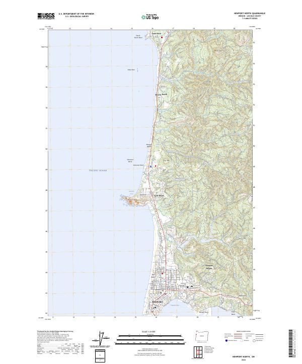
2024 Map of Newport North
USGS Topo · Published 2024About this map
The central Oregon coastline near Newport is defined by a series of prominent marine terraces and rocky headlands, most notably the lighthouse-crowned Yaquina Head. This survey of the early 21st century reveals the densest development concentrated around Nye Beach and the downtown waterfront along SW Bay Blvd, while the northern reaches maintain a string of smaller coastal communities like Agate Beach and Beverly Beach. A heavy emphasis on conservation is evident in the extensive holdings of the Oregon Islands National Wildlife Refuge and the Oregon Islands National Wilderness, which protect the offshore Schooner Rocks and coastal cliffs.
Find a feature on this map
114 named features on this map. Tap any name to fly to it.
Don’t see what you’re looking for? This feature index may not catch every label — zoom into the map to look around manually.
Map Details
Editions of this 2024 Newport North Map
This is the sole edition of this map. No revisions or reprints were ever made.
Other maps of this area

1941 · Cape Foulweather
USGS Topo · 1:62,500

1942 · Euchre Mtn
USGS Topo · 1:62,500

1942 · Yaquina
USGS Topo · 1:62,500

1942 · Toledo
USGS Topo · 1:62,500

1943 · Euchre Mtn
USGS Topo · 1:62,500

1944 · Cape Foulweather
USGS Topo · 1:62,500

1953 · Salem
USGS Topo · 1:250,000

1954 · Salem
USGS Topo · 1:250,000

1957 · Cape Foulweather
USGS Topo · 1:62,500

1957 · Yaquina
USGS Topo · 1:62,500