
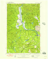
1936 Map of Newport
USGS Topo · Published 1936About this map
Cusick and Usk sit along the banks of the Pend Oreille River in this mid-1930s survey of northeastern Washington. The landscape is defined by the heavy rail infrastructure of the Chicago Milwaukee St Paul and Pacific and the Great Northern railroads, which linked timber and agricultural outposts like Dalkena and Jared to the larger hub of Newport. Significant social and institutional footprints are visible through several rural schoolhouses, including Locke Sch and Jefferson Sch, and the presence of the Indian Mission near Cusick. The map documents a complex water system of high-altitude lakes such as Bead Lake and Sacheen Lake, supporting local industry and recreation. Further south, the transition into the Milan Farms area and the settlement at Camden illustrates the era's focus on organized rural development and resource management, including the State Fish Hatchery north of Usk.
Find a feature on this map
114 named features on this map. Tap any name to fly to it.
Don’t see what you’re looking for? This feature index may not catch every label — zoom into the map to look around manually.
Map Details
Editions of this 1936 Newport Map
2 editions found
Other maps of this area

1901 · Sandpoint
USGS Topo · 1:125,000

1901 · Spokane
USGS Topo · 1:125,000

1903 · Rathdrum
USGS Topo · 1:125,000

1911 · Priest Lake
USGS Topo · 1:250,000

1911 · Sandpoint
USGS Topo · 1:125,000

1913 · Priest Lake
USGS Topo · 1:250,000

1927 · Chewelah
USGS Topo · 1:125,000

1929 · Colville
USGS Topo · 1:125,000

1930 · Chewelah
USGS Topo · 1:125,000

1933 · Colville
USGS Topo · 1:125,000