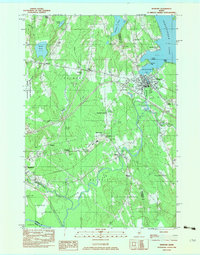
1982 Map of Newport
USGS Topo · Published 1983About this map
Sebasticook Lake serves as the dominant focal point for this region of Central Maine, where the Newport village center sits at the lake's southern outlet. This 1982 survey illustrates a landscape defined by its complex hydrology and the infrastructure of the late twentieth century. To the west, Palmyra and Dogtown are connected by rural roads that weave around numerous wetlands like Robbers Bog and Whites Pond. The industrial and transport history of the area is represented by the Maine Central railroad corridor, which parallels the Sebasticook River through Detroit.
Find a feature on this map
61 named features on this map. Tap any name to fly to it.
Don’t see what you’re looking for? This feature index may not catch every label — zoom into the map to look around manually.
Map Details
Editions of this 1982 Newport Map
2 editions found

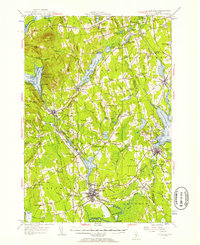
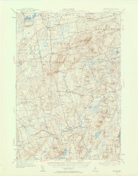
Other maps of this area

1926 · Burnham
USGS Topo · 1:62,500

1930 · Pittsfield
USGS Topo · 1:48,000

1931 · Stetson
USGS Topo · 1:48,000

1932 · Brooks
USGS Topo · 1:62,500

1932 · Pittsfield
USGS Topo · 1:62,500

1933 · Pittsfield
USGS Topo · 1:62,500

1935 · Stetson
USGS Topo · 1:62,500

1948 · Bangor
USGS Topo · 1:250,000
1955 · Pittsfield
USGS Topo · 1:62,500
1955 · Brooks
USGS Topo · 1:62,500