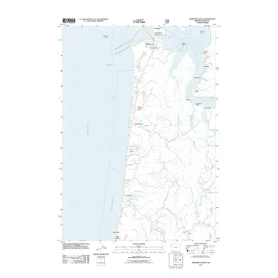
2011 Map of Newport South
USGS Topo · Published 2011About this map
Yaquina Bay and the mouth of the Yaquina River dominate the northern landscape, where the Hatfield Marine Science Center stands as a prominent fixture of the modern coast. The shoreline stretches south from South Beach State Park through a series of coastal settlements including Holiday Beach, Forfar, and Ona Beach, terminating at the distinctive formations of Seal Rock. Inland, the map reveals a dense network of tidal sloughs and winding creeks such as Poole Slough and Henderson Creek, which define the low-lying terrain. The coastal economy and infrastructure of the early 21st century are well-represented by the Newport Municipal Airport and the South Beach Post Office. Further south and east, the transition to rural life is marked by the Lincoln Grange and the confluence of several branches of Beaver Creek.
Find a feature on this map
64 named features on this map. Tap any name to fly to it.
Don’t see what you’re looking for? This feature index may not catch every label — zoom into the map to look around manually.
Map Details
Editions of this 2011 Newport South Map
This is the sole edition of this map. No revisions or reprints were ever made.
Other maps of this area

1922 · Waldport
USGS Topo · 1:62,500

1942 · Waldport
USGS Topo · 1:62,500

1942 · Yaquina
USGS Topo · 1:62,500

1942 · Tidewater
USGS Topo · 1:62,500

1942 · Toledo
USGS Topo · 1:62,500

1953 · Salem
USGS Topo · 1:250,000

1954 · Salem
USGS Topo · 1:250,000

1956 · Tidewater
USGS Topo · 1:62,500

1956 · Waldport
USGS Topo · 1:62,500

1957 · Yaquina
USGS Topo · 1:62,500