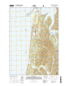
2017 Map of Newport South
USGS Topo · Published 2017About this map
Yaquina Bay and the winding Yaquina River dominate this coastal landscape, where maritime geography dictates the layout of long-established settlements. The rugged Pacific shoreline is anchored by South Beach and the distinctive Yaquina Reef, while the tidal estuary inland is defined by numerous sloughs such as King Slough and Poole Slough. The interface of water and land is further shaped by McCaffrey Island and the sharp turn known as The Bend.
Find a feature on this map
72 named features on this map. Tap any name to fly to it.
Don’t see what you’re looking for? This feature index may not catch every label — zoom into the map to look around manually.
Map Details
Editions of this 2017 Newport South Map
This is the sole edition of this map. No revisions or reprints were ever made.
Other maps of this area

1922 · Waldport
USGS Topo · 1:62,500

1942 · Waldport
USGS Topo · 1:62,500

1942 · Yaquina
USGS Topo · 1:62,500

1942 · Tidewater
USGS Topo · 1:62,500

1942 · Toledo
USGS Topo · 1:62,500

1953 · Salem
USGS Topo · 1:250,000

1954 · Salem
USGS Topo · 1:250,000

1956 · Tidewater
USGS Topo · 1:62,500

1956 · Waldport
USGS Topo · 1:62,500

1957 · Yaquina
USGS Topo · 1:62,500