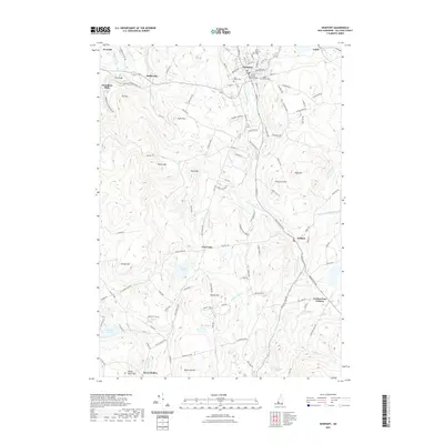
2021 Map of Newport
USGS Topo · Published 2021About this map
The Sullivan County Courthouse stands as a central landmark in Newport, New Hampshire, anchoring a community defined by its proximity to the Sugar River and its various tributaries. This 2021 survey shows a well-established town layout, where local history is preserved at the Saint Patricks Cemetery, Pine Street Cemetery, and Maple Street Cemetery. The New England Central Railroad line tracks through the northern section, following the river valley through Kelleyville and near the settlement of Guild.
Find a feature on this map
130 named features on this map. Tap any name to fly to it.
Don’t see what you’re looking for? This feature index may not catch every label — zoom into the map to look around manually.
Map Details
Editions of this 2021 Newport Map
This is the sole edition of this map. No revisions or reprints were ever made.
Other maps of this area

1902 · Sunapee
USGS Topo · 1:62,500

1905 · Sunapee
USGS Topo · 1:62,500

1907 · Sunapee
USGS Topo · 1:62,500

1926 · Claremont
USGS Topo · 1:62,500

1927 · Bellows Falls
USGS Topo · 1:48,000

1929 · Claremont
USGS Topo · 1:62,500

1930 · Lovewell Mountain
USGS Topo · 1:62,500

1930 · Bellows Falls
USGS Topo · 1:62,500

1942 · Lovewell Mountain
USGS Topo · 1:62,500

1950 · Glens Falls
USGS Topo · 1:250,000