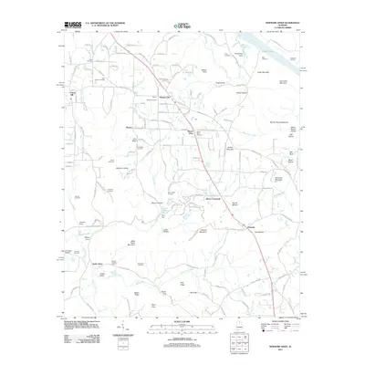
2011 Map of Newsome Sinks
USGS Topo · Published 2011About this map
Newsome Sinks characterizes the dramatic karst topography of this North Alabama landscape, where numerous blind valleys and sinks punctuate the terrain. The settlement pattern is defined by rural crossroads and small communities such as Morgan City, Allens Crossroads, and Oleander, many of which are linked by winding roads that navigate the complex ridges and hollows. Along the northern edge, the Tennessee River and Wheeler Lake provide a sharp contrast to the upland terrain, marked by Clarksville Landing and the prominence of Cedar Mountain. Numerous family and community burial grounds, including Mount Olive Cemetery and the Saints Cemetery, are scattered throughout the quadrangle, offering significant touchpoints for genealogical research. The presence of Lynn Mill Pond and Lynn Dam indicates the historical importance of water management for local industry and agriculture in this well-watered region of the Tennessee Valley.
Find a feature on this map
171 named features on this map. Tap any name to fly to it.
Don’t see what you’re looking for? This feature index may not catch every label — zoom into the map to look around manually.
Map Details
Editions of this 2011 Newsome Sinks Map
This is the sole edition of this map. No revisions or reprints were ever made.
Other maps of this area

1885 · Gadsden
USGS Topo · 1:125,000

1888 · Cullman
USGS Topo · 1:125,000

1888 · Gadsden
USGS Topo · 1:125,000

1888 · Scottsboro
USGS Topo · 1:125,000

1888 · Huntsville
USGS Topo · 1:125,000

1892 · Cullman
USGS Topo · 1:125,000

1892 · Huntsville
USGS Topo · 1:125,000

1892 · Scottsboro
USGS Topo · 1:125,000

1892 · Gadsden
USGS Topo · 1:125,000

1895 · Gadsden
USGS Topo · 1:125,000