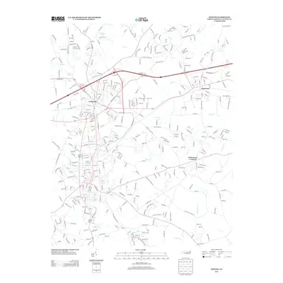
2013 Map of Newton
USGS Topo · Published 2013About this map
Conover and Claremont anchor this portion of the Catawba County landscape, showcasing the dense residential and industrial grids typical of the Interstate 40 corridor in the early 21st century. The map illustrates a high degree of suburban development interspersed with an intricate drainage network including Lyle Creek and Mull Creek to the north, and McLin Creek flowing through the central section.
Find a feature on this map
360 named features on this map. Tap any name to fly to it.
Don’t see what you’re looking for? This feature index may not catch every label — zoom into the map to look around manually.
Map Details
Editions of this 2013 Newton Map
This is the sole edition of this map. No revisions or reprints were ever made.
Other maps of this area

1895 · Hickory
USGS Topo · 1:125,000

1953 · Charlotte
USGS Topo · 1:250,000

1954 · Charlotte
USGS Topo · 1:250,000

1960 · Charlotte
USGS Topo · 1:250,000

1962 · Charlotte
USGS Topo · 1:250,000
1970 · Maiden
USGS Topo · 1:24,000

1970 · Bethlehem
USGS Topo · 1:24,000

1970 · Newton
USGS Topo · 1:24,000
1970 · Catawba
USGS Topo · 1:24,000
1970 · Denver
USGS Topo · 1:24,000