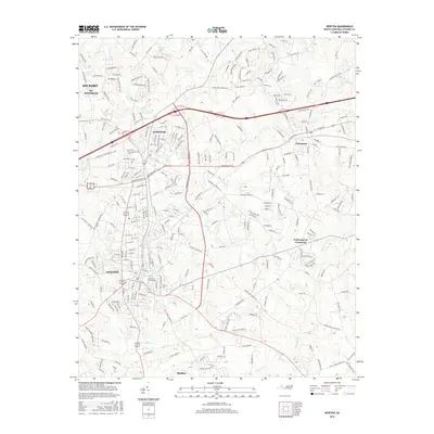
2016 Map of Newton
USGS Topo · Published 2016About this map
Newton and Conover serve as the primary hubs in this part of Catawba County, showing the dense street grids and growing residential patterns characteristic of the mid-2010s. The landscape is defined by its transition from urban centers to rural crossroads, with smaller settlements like Maiden and Claremont connected by a network of local roads such as Saint Pauls Church Rd and Old Conover-Startown Rd. This geographic arrangement illustrates the persistent importance of regional corridors in North Carolina's western Piedmont.
Find a feature on this map
273 named features on this map. Tap any name to fly to it.
Don’t see what you’re looking for? This feature index may not catch every label — zoom into the map to look around manually.
Map Details
Editions of this 2016 Newton Map
This is the sole edition of this map. No revisions or reprints were ever made.
Other maps of this area

1895 · Hickory
USGS Topo · 1:125,000

1953 · Charlotte
USGS Topo · 1:250,000

1954 · Charlotte
USGS Topo · 1:250,000

1960 · Charlotte
USGS Topo · 1:250,000

1962 · Charlotte
USGS Topo · 1:250,000
1970 · Maiden
USGS Topo · 1:24,000

1970 · Bethlehem
USGS Topo · 1:24,000

1970 · Newton
USGS Topo · 1:24,000
1970 · Catawba
USGS Topo · 1:24,000
1970 · Denver
USGS Topo · 1:24,000