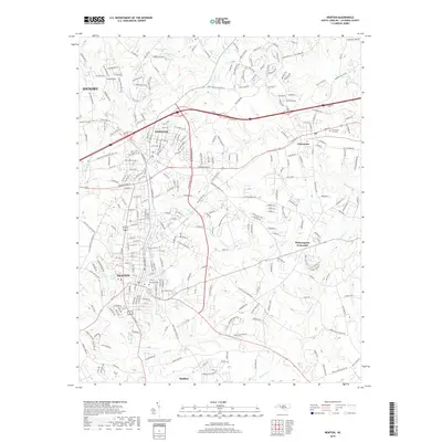
2019 Map of Newton
USGS Topo · Published 2019About this map
Newton and Conover anchor this modern-era study of Catawba County, revealing a landscape defined by an intricate network of residential expansion and local watercourses. The map traces the dense development between Hickory and Claremont, where neighborhood streets like Pipers Ridge Cir NW and Laliber Dr have integrated into the older rural grid. Historical continuity is maintained through several prominent burial grounds, including the Claremont City Cem and Eastview Cem, which serve as permanent landmarks amidst the shifting urban footprint.
Find a feature on this map
286 named features on this map. Tap any name to fly to it.
Don’t see what you’re looking for? This feature index may not catch every label — zoom into the map to look around manually.
Map Details
Editions of this 2019 Newton Map
This is the sole edition of this map. No revisions or reprints were ever made.
Other maps of this area

1895 · Hickory
USGS Topo · 1:125,000

1953 · Charlotte
USGS Topo · 1:250,000

1954 · Charlotte
USGS Topo · 1:250,000

1960 · Charlotte
USGS Topo · 1:250,000

1962 · Charlotte
USGS Topo · 1:250,000
1970 · Maiden
USGS Topo · 1:24,000

1970 · Bethlehem
USGS Topo · 1:24,000

1970 · Newton
USGS Topo · 1:24,000
1970 · Catawba
USGS Topo · 1:24,000
1970 · Denver
USGS Topo · 1:24,000