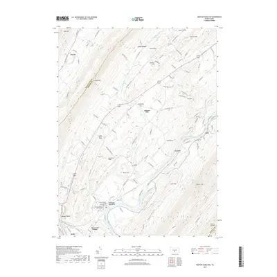
2019 Map of Newton Hamilton
USGS Topo · Published 2019About this map
The Juniata River carves a winding path through this central Pennsylvania landscape, defining the boundaries and movement of the region. Along its banks, the borough of Newton Hamilton serves as a focal point, surrounded by several smaller settlements and clusters of family-named landmarks. The terrain is characterized by a series of prominent ridges and hollows, including Jacks Mountain, Long Hollow Ridge, and Sugar Ridge, which have historically shaped the agricultural and transport patterns of Mifflin Co and Huntingdon County.
Find a feature on this map
112 named features on this map. Tap any name to fly to it.
Don’t see what you’re looking for? This feature index may not catch every label — zoom into the map to look around manually.
Map Details
Editions of this 2019 Newton Hamilton Map
This is the sole edition of this map. No revisions or reprints were ever made.
Other maps of this area

1919 · Mattawana
USGS Topo · 1:62,500

1919 · Menno
USGS Topo · 1:62,500

1922 · Mt Union
USGS Topo · 1:48,000

1924 · Mt. Union
USGS Topo · 1:62,500

1924 · Lewistown
USGS Topo · 1:62,500

1927 · Lewisburg
USGS Topo · 1:62,500

1935 · Allensville
USGS Topo · 1:62,500

1936 · East Waterford
USGS Topo · 1:48,000

1938 · Allensville
USGS Topo · 1:62,500

1941 · East Waterford
USGS Topo · 1:62,500
Featured Places
- Kistler, PA
- Newton Hamilton, PA
- Bratton Township, PA
- Ryde, Wayne Township
- Little Kansas, Oliver Township