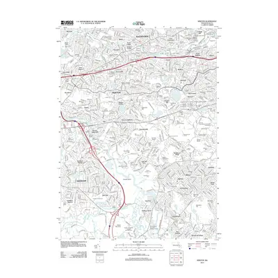
2012 Map of Newton
USGS Topo · Published 2012About this map
The Charles River forms the geographic spine of this suburban landscape, winding through a dense network of villages and historic centers. Long-established neighborhoods like Newtonville, Auburndale, and Waban appear alongside institutional landmarks such as Boston College and Pine Manor Junior College. The map highlights the area's rich educational and civic history, with numerous junior colleges and religious institutions like Aquinas Junior College and the Saint Josephs Cem dotting the terrain from Newton Corner down to East Dedham.
Find a feature on this map
160 named features on this map. Tap any name to fly to it.
Don’t see what you’re looking for? This feature index may not catch every label — zoom into the map to look around manually.
Map Details
Editions of this 2012 Newton Map
This is the sole edition of this map. No revisions or reprints were ever made.
Other maps of this area

1886 · Dedham
USGS Topo · 1:62,500

1886 · Framingham
USGS Topo · 1:62,500

1887 · Franklin
USGS Topo · 1:62,500

1889 · Franklin
USGS Topo · 1:62,500

1889 · Framingham
USGS Topo · 1:62,500

1893 · Franklin
USGS Topo · 1:62,500

1893 · Boston
USGS Topo · 1:62,500

1894 · Dedham
USGS Topo · 1:62,500

1894 · Framingham
USGS Topo · 1:62,500

1903 · Boston
USGS Topo · 1:62,500