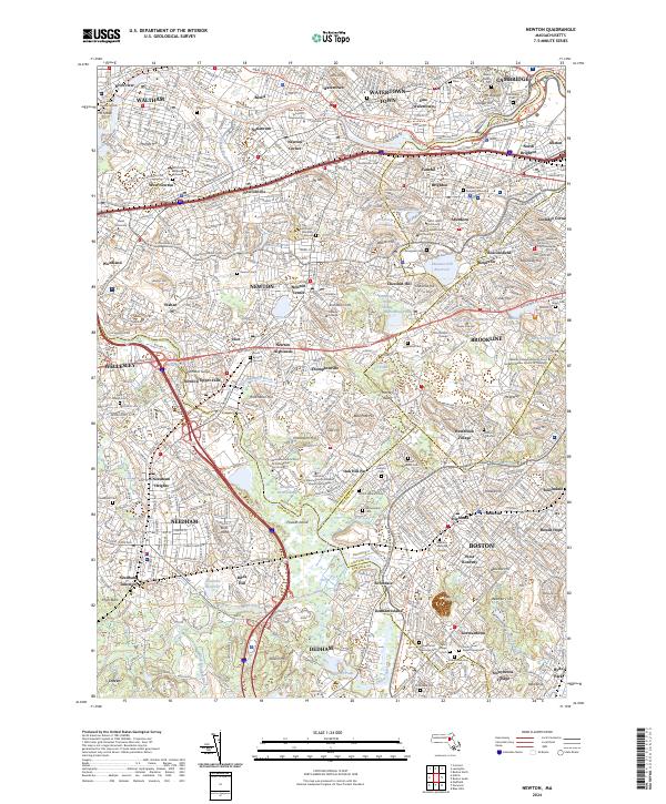
2024 Map of Newton
USGS Topo · Published 2024About this map
The Charles River winds through this densely populated corridor, defining the boundaries of historic neighborhoods from Waltham and Watertown down to West Roxbury. The landscape is a dense network of suburban villages and prestigious institutions, including Boston College, Lasell University, and Pine Manor College. Public works and green spaces are prominent, highlighted by the Chestnut Hill Reservoir and the Frederick Law Olmsted National Historic Site.
Find a feature on this map
144 named features on this map. Tap any name to fly to it.
Don’t see what you’re looking for? This feature index may not catch every label — zoom into the map to look around manually.
Map Details
Editions of this 2024 Newton Map
This is the sole edition of this map. No revisions or reprints were ever made.
Other maps of this area

1886 · Dedham
USGS Topo · 1:62,500

1886 · Framingham
USGS Topo · 1:62,500

1887 · Franklin
USGS Topo · 1:62,500

1889 · Franklin
USGS Topo · 1:62,500

1889 · Framingham
USGS Topo · 1:62,500

1893 · Franklin
USGS Topo · 1:62,500

1893 · Boston
USGS Topo · 1:62,500

1894 · Dedham
USGS Topo · 1:62,500

1894 · Framingham
USGS Topo · 1:62,500

1903 · Boston
USGS Topo · 1:62,500