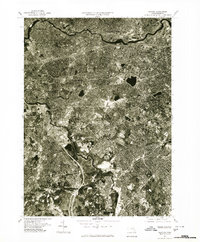
1977 Map of Newton
USGS Topo · Published 1980About this map
The Charles River winds through the heart of this suburban landscape, serving as a defining geographic boundary between several prominent Massachusetts communities. Captured in the late 1970s, the dense residential and commercial development of Newton is central to the area, surrounded by the established neighborhoods of Brookline and the urban reach of Boston and Cambridge. This orthophoto map provides a unique visual record of the region's mid-century expansion and infrastructure, showing the intricate street patterns and land use that connected these historical townships.
Find a feature on this map
10 named features on this map. Tap any name to fly to it.
Don’t see what you’re looking for? This feature index may not catch every label — zoom into the map to look around manually.
Map Details
Editions of this 1977 Newton Map
This is the sole edition of this map. No revisions or reprints were ever made.
Other maps of this area

1886 · Dedham
USGS Topo · 1:62,500

1886 · Framingham
USGS Topo · 1:62,500

1887 · Franklin
USGS Topo · 1:62,500

1889 · Franklin
USGS Topo · 1:62,500

1889 · Framingham
USGS Topo · 1:62,500

1893 · Franklin
USGS Topo · 1:62,500

1893 · Boston
USGS Topo · 1:62,500

1894 · Dedham
USGS Topo · 1:62,500

1894 · Framingham
USGS Topo · 1:62,500

1903 · Boston
USGS Topo · 1:62,500