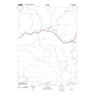
2011 Map of Newton
USGS Topo · Published 2011About this map
Big Sandy Creek and its complex network of tributaries, including Granny Creek and Blountimber Run, define the winding hollows of Clay County in this 2011 survey. Local infrastructure is anchored by a string of small post offices at Newton, Wallback, Left Hand, and Ovapa, reflecting the persistence of rural communities along the state’s ridgelines. Family history is well-preserved across the landscape, with numerous hilltop burial grounds such as Smith Cemetery and Grose Cemetery located near the headwaters of Laurel Creek and Summers Fork. The map shows a clear contrast between the older network of ridge roads like Pumpkin Ridge Rd and the more modern interstate corridor that now cuts through the heart of the terrain, crossing over Cutoff Run and Right Fork Big Sandy Creek. Higher elevations like Pilot Knob and Weedy Knob overlook the deeply carved valleys near the Elk River at King.
Find a feature on this map
71 named features on this map. Tap any name to fly to it.
Don’t see what you’re looking for? This feature index may not catch every label — zoom into the map to look around manually.
Map Details
Editions of this 2011 Newton Map
This is the sole edition of this map. No revisions or reprints were ever made.
Other maps of this area

1897 · Kanawha Falls
USGS Topo · 1:125,000

1900 · Kanawha Falls
USGS Topo · 1:125,000

1901 · Kanawha Falls
USGS Topo · 1:125,000

1906 · Otter
USGS Topo · 1:62,500

1906 · Walton
USGS Topo · 1:62,500

1907 · Otter
USGS Topo · 1:62,500

1907 · Walton
USGS Topo · 1:62,500

1907 · Clendenin
USGS Topo · 1:62,500

1908 · Clay
USGS Topo · 1:48,000

1909 · Clendenin
USGS Topo · 1:62,500