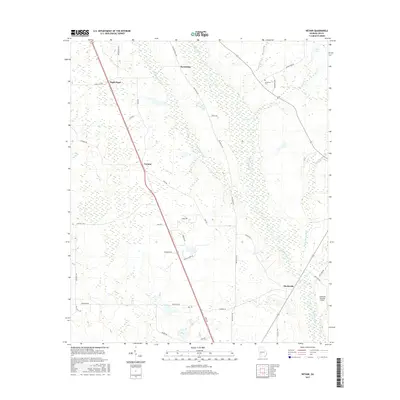
2017 Map of Neyami
USGS Topo · Published 2017About this map
Muckalee Creek and its many winding tributaries define this section of Lee County, Georgia, where the land transitions from agricultural fields to the densely wooded wetlands of the coastal plain. Small rural settlements like Neyami and Scrutchins are connected by a network of local roads such as Smithville Rd and Dixie Rd, illustrating the dispersed residential patterns typical of the region's long-standing farming economy. Near the southern edge of the quadrangle, Starksville sits adjacent to the swampy reaches of the creek, a location that historically served as a county seat before being bypassed by railroad development.
Find a feature on this map
41 named features on this map. Tap any name to fly to it.
Don’t see what you’re looking for? This feature index may not catch every label — zoom into the map to look around manually.
Map Details
Editions of this 2017 Neyami Map
This is the sole edition of this map. No revisions or reprints were ever made.
Other maps of this area

1953 · Dothan
USGS Topo · 1:250,000

1954 · Dothan
USGS Topo · 1:250,000

1955 · Dothan
USGS Topo · 1:250,000

1956 · Sasser
USGS Topo · 1:62,500

1956 · Albany
USGS Topo · 1:62,500

1956 · Leslie
USGS Topo · 1:62,500

1973 · Sasser
USGS Topo · 1:24,000
1973 · Bronwood
USGS Topo · 1:24,000
1973 · Albany NE
USGS Topo · 1:24,000
1973 · Neyami
USGS Topo · 1:24,000