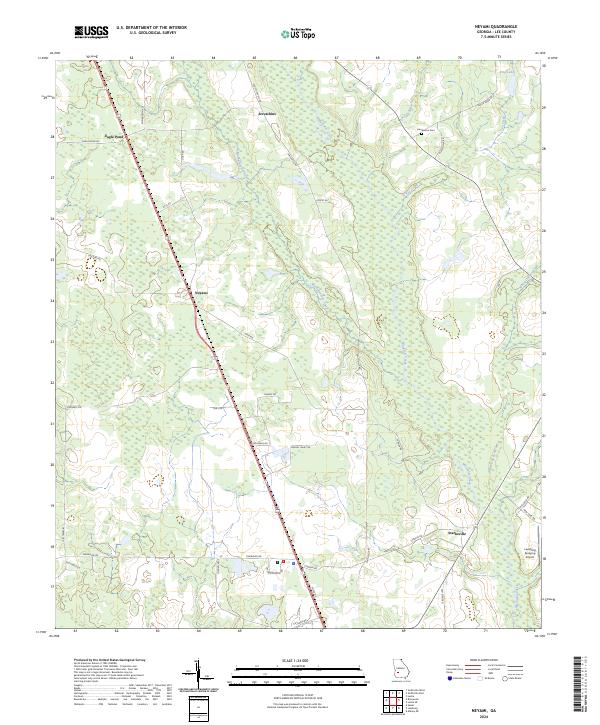
2024 Map of Neyami
USGS Topo · Published 2024About this map
Starksville and the agricultural lands of Lee County define this central Georgia landscape, where the meandering Muckalee Creek and Muckaloochee Creek flow through low-lying wetlands. The area is characterized by a sparse settlement pattern of small communities like Neyami and Scrutchins, connected by a network of rural roads such as Old Smithville Rd and Old Stage Rd. This modern survey reveals the continued importance of land use in the region, featuring the State Prison facility and the Leesburg Spraying Airport, the latter reflecting the area's ongoing reliance on aviation-supported agriculture.
Find a feature on this map
40 named features on this map. Tap any name to fly to it.
Don’t see what you’re looking for? This feature index may not catch every label — zoom into the map to look around manually.
Map Details
Editions of this 2024 Neyami Map
This is the sole edition of this map. No revisions or reprints were ever made.
Other maps of this area

1953 · Dothan
USGS Topo · 1:250,000

1954 · Dothan
USGS Topo · 1:250,000

1955 · Dothan
USGS Topo · 1:250,000

1956 · Sasser
USGS Topo · 1:62,500

1956 · Albany
USGS Topo · 1:62,500

1956 · Leslie
USGS Topo · 1:62,500

1973 · Sasser
USGS Topo · 1:24,000
1973 · Bronwood
USGS Topo · 1:24,000
1973 · Albany NE
USGS Topo · 1:24,000
1973 · Neyami
USGS Topo · 1:24,000