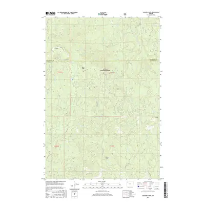
2017 Map of Niagara Creek
USGS Topo · Published 2017About this map
Siuslaw National Forest encompasses this deeply dissected landscape, where the headwaters of several significant drainage systems converge at the border of Yamhill Co and Tillamook Co. High points such as Mt Hebo and the curiously named Burnt Ridge overlook a complex network of forest development roads and stream valleys, including the descent of Niagara Cr and Agency Cr. The terrain is punctuated by small mountain waters like North Lake and South Lake, while the curiosity of Asinine Bridge stands as a notable human-named landmark over Agency Cr. Further south, the map traces the intricate paths of Three Rivers and the W Fork Agency Cr, illustrating the dense hydrological web that defines this portion of the Northern Oregon Coast Range. This survey provides a precise record of the road network used for forest management, such as the SW Little Hebo Rd and SW Yoncalla Creek Rd.
Find a feature on this map
38 named features on this map. Tap any name to fly to it.
Don’t see what you’re looking for? This feature index may not catch every label — zoom into the map to look around manually.
Map Details
Editions of this 2017 Niagara Creek Map
This is the sole edition of this map. No revisions or reprints were ever made.
Other maps of this area

1941 · Nestucca Bay
USGS Topo · 1:62,500

1942 · Ginger Peak
USGS Topo · 1:62,500

1942 · Spirit Mtn
USGS Topo · 1:62,500

1942 · Nestucca Bay
USGS Topo · 1:62,500

1942 · Tillamook
USGS Topo · 1:62,500

1948 · Vancouver
USGS Topo · 1:250,000

1950 · Vancouver
USGS Topo · 1:250,000

1950 · Vancouver
USGS Topo · 1:250,000

1955 · Hebo
USGS Topo · 1:62,500

1955 · Blaine
USGS Topo · 1:62,500