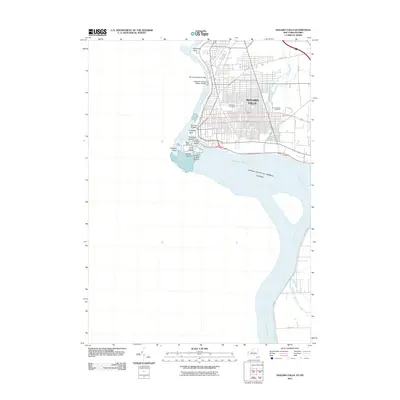
2011 Map of Niagara Falls
USGS Topo · Published 2011About this map
Niagara Falls sits at the precipice of the border between the United States and Canada in this early 21st-century survey. The urban grid of the city extends to the very edge of the river gorge, where major infrastructure such as the Whirlpool Rapids Bridge and the Michigan Central Railway Bridge span the Niagara River. The map highlights the complex geography of the falls area, including Goat Island and the smaller Three Sisters Islands situated among the cascading waters.
Find a feature on this map
34 named features on this map. Tap any name to fly to it.
Don’t see what you’re looking for? This feature index may not catch every label — zoom into the map to look around manually.
Map Details
Editions of this 2011 Niagara Falls Map
This is the sole edition of this map. No revisions or reprints were ever made.
Other maps of this area

1894 · Buffalo
USGS Topo · 1:62,500

1894 · Niagara Falls
USGS Topo · 1:62,500

1896 · Niagara Falls
USGS Topo · 1:62,500

1897 · Tonawanda
USGS Topo · 1:62,500

1899 · Niagara
USGS Topo · 1:125,000

1900 · Tonawanda
USGS Topo · 1:62,500

1900 · Niagara Falls
USGS Topo · 1:62,500

1901 · Buffalo
USGS Topo · 1:62,500

1901 · Niagara Falls
USGS Topo · 1:62,500

1901 · Tonawanda
USGS Topo · 1:62,500