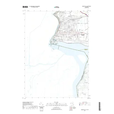
2019 Map of Niagara Falls
USGS Topo · Published 2019About this map
The Niagara River serves as the international boundary and dominant geographic force on this modern topographic study, where the industrial and urban grid of Niagara Falls meets the powerful hydrology of the Niagara Gorge. The map documents the dense street network of the city, highlighting local landmarks like the Angelo Del-signore Civic Building and transit history preserved in the Michigan Central Railway Bridge. The river's dramatic course is punctuated by landmarks such as Whirlpool Point and the Whirlpool Rapids Bridge, while the cataracts themselves are detailed via American Falls and Bridal Veil Falls. Moving south, the map captures the transition to the sprawling parkland and residential areas of Grand Island. Genealogists and local historians can locate long-standing institutions like Oakwood Cem and Saint Joseph's Cem, which are situated within the heart of the city's established residential blocks.
Find a feature on this map
90 named features on this map. Tap any name to fly to it.
Don’t see what you’re looking for? This feature index may not catch every label — zoom into the map to look around manually.
Map Details
Editions of this 2019 Niagara Falls Map
This is the sole edition of this map. No revisions or reprints were ever made.
Other maps of this area

1894 · Buffalo
USGS Topo · 1:62,500

1894 · Niagara Falls
USGS Topo · 1:62,500

1896 · Niagara Falls
USGS Topo · 1:62,500

1897 · Tonawanda
USGS Topo · 1:62,500

1899 · Niagara
USGS Topo · 1:125,000

1900 · Tonawanda
USGS Topo · 1:62,500

1900 · Niagara Falls
USGS Topo · 1:62,500

1901 · Buffalo
USGS Topo · 1:62,500

1901 · Niagara Falls
USGS Topo · 1:62,500

1901 · Tonawanda
USGS Topo · 1:62,500