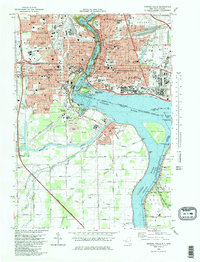
1980 Map of Niagara Falls
USGS Topo · Published 1981About this map
Niagara Falls dominates this 1980 survey, showing the complex international border and industrial infrastructure surrounding the cataracts. The map details the transition from the densely developed city center, featuring landmarks like the Convention Center and Oakwood Cemetery, to the southern reaches where the Niagara River Chippawa Channel flows past Navy Island and Buckhorn Island State Park. Local transportation networks are well-defined, including the Conrail lines and the Canadian Stamford Station.
Find a feature on this map
69 named features on this map. Tap any name to fly to it.
Don’t see what you’re looking for? This feature index may not catch every label — zoom into the map to look around manually.
Map Details
Editions of this 1980 Niagara Falls Map
This is the sole edition of this map. No revisions or reprints were ever made.
Other maps of this area

1894 · Buffalo
USGS Topo · 1:62,500

1894 · Niagara Falls
USGS Topo · 1:62,500

1896 · Niagara Falls
USGS Topo · 1:62,500

1897 · Tonawanda
USGS Topo · 1:62,500

1899 · Niagara
USGS Topo · 1:125,000

1900 · Tonawanda
USGS Topo · 1:62,500

1900 · Niagara Falls
USGS Topo · 1:62,500

1901 · Buffalo
USGS Topo · 1:62,500

1901 · Niagara Falls
USGS Topo · 1:62,500

1901 · Tonawanda
USGS Topo · 1:62,500