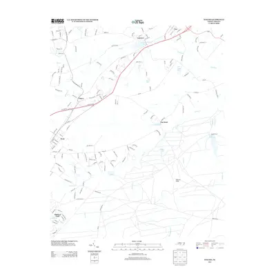
2013 Map of Niagara
USGS Topo · Published 2013About this map
Niagara and Lakeview serve as central points in this Southern Pines area landscape, where the traditional rail corridor parallels the path of modern development. The drainage of the Little River and its numerous tributaries, including McDeeds Cr and Mill Cr, shapes the settlement patterns seen here. Notable water bodies like Crystal Lake and Griffin Lake are interspersed among residential clusters such as Vass and Manly. Further south, the map reveals a more specialized terrain, featuring Railroad Ridge and the distinctively named Hog Island near Lake Bay. This survey documents a transitional era where older communities and natural features like Tuckahoe Cr meet the expanding reach of roads such as Camp Easter Rd and Niagara Carthage Rd.
Find a feature on this map
139 named features on this map. Tap any name to fly to it.
Don’t see what you’re looking for? This feature index may not catch every label — zoom into the map to look around manually.
Map Details
Editions of this 2013 Niagara Map
This is the sole edition of this map. No revisions or reprints were ever made.
Other maps of this area

1948 · Southern Pines
USGS Topo · 1:62,500

1948 · Clifdale
USGS Topo · 1:62,500

1948 · Pinebluff
USGS Topo · 1:24,000

1948 · Nicholson Creek
USGS Topo · 1:24,000

1948 · Mc Cain
USGS Topo · 1:24,000

1950 · Sanatorium
USGS Topo · 1:24,000

1950 · Lobelia
USGS Topo · 1:24,000

1950 · Pine Bluff
USGS Topo · 1:24,000

1950 · Niagara
USGS Topo · 1:24,000

1950 · Southern Pines
USGS Topo · 1:24,000