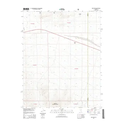
2015 Map of Niavi Wash
USGS Topo · Published 2015About this map
Toiyabe National Forest dominates the southern landscape of this Clark County region, where the terrain shifts toward the northern reaches of the Mojave Desert. The map documents a rugged transition of high-elevation ridges and drainage basins, notably South Ridge and the winding Timpi Canyon. These natural corridors dictate the path of seasonal water flow through Timpi Wash and Niavi Wash, which cut across the arid environment. Infrastructure is sparse in this desert expanse, defined primarily by the crossing of U.S. Route 95 and the Mercury Hwy near the border of Nye and Clark Counties. This survey illustrates the isolation of the high desert before reaching the more developed areas to the south, preserving the mid-2010s state of these public lands and transportation corridors.
Find a feature on this map
15 named features on this map. Tap any name to fly to it.
Don’t see what you’re looking for? This feature index may not catch every label — zoom into the map to look around manually.
Map Details
Editions of this 2015 Niavi Wash Map
This is the sole edition of this map. No revisions or reprints were ever made.
Other maps of this area

1907 · Las Vegas
USGS Topo · 1:250,000

1908 · Furnace Creek
USGS Topo · 1:250,000

1908 · Las Vegas
USGS Topo · 1:250,000

1910 · Furnace Creek
USGS Topo · 1:250,000

1942 · Indian Spring
USGS Topo · 1:125,000

1942 · Skull Mountain
USGS Topo · 1:125,000

1948 · Death Valley
USGS Topo · 1:250,000

1952 · Specter Range
USGS Topo · 1:62,500

1952 · Mercury
USGS Topo · 1:62,500

1954 · Las Vegas
USGS Topo · 1:250,000