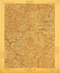
1901 Map of Nicholas
USGS Topo · Published 1912About this map
Deep river valleys and high ridges characterize this central West Virginia landscape as it appeared just before the turn of the century. The Gauley River and Meadow River carve winding paths through the terrain, historically navigated by river crossings such as Carnifix Ferry and Brock's Ferry. The settlement of Summersville Town serves as a central hub, while the emerging industrial presence of Richwood and Camden on Gauley hints at the timber and resource extraction beginning to reshape the region.
Find a feature on this map
173 named features on this map. Tap any name to fly to it.
Don’t see what you’re looking for? This feature index may not catch every label — zoom into the map to look around manually.
Map Details
Editions of this 1901 Nicholas Map
3 editions found

Other maps of this area

1887 · Hinton
USGS Topo · 1:125,000

1887 · Lewisburg
USGS Topo · 1:125,000

1889 · Nicholas
USGS Topo · 1:125,000

1891 · Lewisburg
USGS Topo · 1:125,000

1891 · Nicholas
USGS Topo · 1:125,000

1891 · Huntersville
USGS Topo · 1:125,000

1891 · Raleigh
USGS Topo · 1:125,000

1892 · Hinton
USGS Topo · 1:125,000

1893 · Buckhannon
USGS Topo · 1:125,000

1893 · Sutton
USGS Topo · 1:125,000