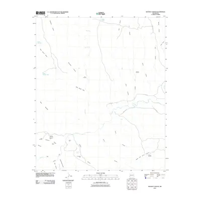
2010 Map of Nichols Canyon
USGS Topo · Published 2010About this map
Mining claims and water infrastructure define this arid landscape in Grant County, concentrated along the rugged drainage systems that feed toward the Gila River. Significant mineral activity is evident in the southern reaches, including the Black Bob Group Mine Remington Lode, Wilson Mine, and Consolation Mine. These sites, alongside the Winnie Claim, suggest a history of extraction focused on the complex geology near Deadman Ridge and the Lower Box Canyon.
Find a feature on this map
35 named features on this map. Tap any name to fly to it.
Don’t see what you’re looking for? This feature index may not catch every label — zoom into the map to look around manually.
Map Details
Editions of this 2010 Nichols Canyon Map
This is the sole edition of this map. No revisions or reprints were ever made.
Other maps of this area

1954 · Silver City
USGS Topo · 1:250,000

1958 · Silver City
USGS Topo · 1:250,000

1959 · Steeple Rock
USGS Topo · 1:62,500

1959 · Redrock
USGS Topo · 1:62,500

1959 · Canador Peak
USGS Topo · 1:62,500

1959 · Cliff
USGS Topo · 1:62,500

1962 · Silver City
USGS Topo · 1:250,000
1990 · Willow Draw
USGS Topo · 1:24,000
1990 · Walker Canyon
USGS Topo · 1:24,000
1990 · Steeple Rock
USGS Topo · 1:24,000