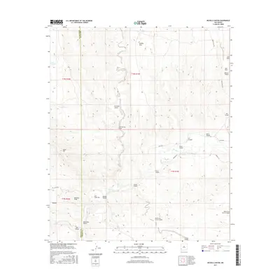
2017 Map of Nichols Canyon
USGS Topo · Published 2017About this map
The Gila River winds through the high desert of the New Mexico borderlands, cutting a deep path through the Gila Lower Box and White Rock Canyon. This landscape is defined by its dramatic relief, where the water's course is flanked by prominent features like Black Mtn and the sheer faces of Rimrock. The confluence with Blue Creek serves as a focal point for the drainage patterns that have shaped these canyons over millennia.
Find a feature on this map
35 named features on this map. Tap any name to fly to it.
Don’t see what you’re looking for? This feature index may not catch every label — zoom into the map to look around manually.
Map Details
Editions of this 2017 Nichols Canyon Map
This is the sole edition of this map. No revisions or reprints were ever made.
Other maps of this area

1954 · Silver City
USGS Topo · 1:250,000

1958 · Silver City
USGS Topo · 1:250,000

1959 · Steeple Rock
USGS Topo · 1:62,500

1959 · Redrock
USGS Topo · 1:62,500

1959 · Canador Peak
USGS Topo · 1:62,500

1959 · Cliff
USGS Topo · 1:62,500

1962 · Silver City
USGS Topo · 1:250,000
1990 · Willow Draw
USGS Topo · 1:24,000
1990 · Walker Canyon
USGS Topo · 1:24,000
1990 · Steeple Rock
USGS Topo · 1:24,000