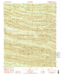
1986 Map of Nichols Mountain
USGS Topo · Published 1986About this map
Ouachita National Forest dominates this mid-1980s terrain, where the topography is defined by the east-west ridges of the Missouri Mountains and the Hanna Range. The small settlement of Shady and the geographic marker of Nichols Mountain provide human orientation in a landscape largely dedicated to conservation. Within the Caney Creek State Wildlife Management Area, the map documents numerous peaks including Tall Peak and Katy Mountain, while lower elevations are carved by a dense network of watercourses such as the Cossatot River and Saline River. A notable Mine label near Sugar Creek suggests the area's history of extraction. The presence of numerous passes, like Wolf Pen Gap and Dicks Gap, indicates how travelers navigated these steep Ouachita ridges before modern infrastructure fully bypassed the more difficult terrain.
Find a feature on this map
50 named features on this map. Tap any name to fly to it.
Don’t see what you’re looking for? This feature index may not catch every label — zoom into the map to look around manually.
Map Details
Editions of this 1986 Nichols Mountain Map
2 editions found
Other maps of this area

1890 · Mount Ida
USGS Topo · 1:125,000

1890 · Poteau Mountain
USGS Topo · 1:125,000

1899 · Poteau Mountain
USGS Topo · 1:125,000

1906 · Caddo Gap
USGS Topo · 1:125,000

1913 · De Queen
USGS Topo · 1:125,000

1936 · Athens
USGS Topo · 1:48,000

1942 · Athens
USGS Topo · 1:62,500

1950 · Mcalester
USGS Topo · 1:250,000

1955 · Little Rock
USGS Topo · 1:250,000

1956 · Little Rock
USGS Topo · 1:250,000