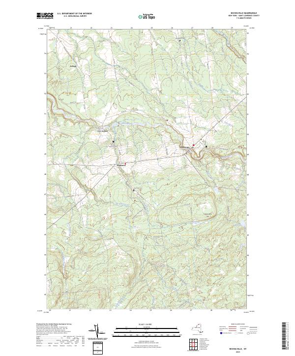
2023 Map of Nicholville
USGS Topo · Published 2023About this map
The Saint Regis River winds through the northern settlements of Saint Lawrence County, anchoring a landscape where small villages and rural crossroads define the terrain. Nicholville and Hopkinton serve as the primary population centers, connected by a network of local roads like Port Kent Rd and Days Mills Rd. The presence of several significant burial grounds, including the Fort Jackson Hopkinton Cem and Holy Cross Cem, provides clear reference points for those tracing family history in the area.
Find a feature on this map
55 named features on this map. Tap any name to fly to it.
Don’t see what you’re looking for? This feature index may not catch every label — zoom into the map to look around manually.
Map Details
Editions of this 2023 Nicholville Map
This is the sole edition of this map. No revisions or reprints were ever made.
Other maps of this area

1906 · Massena
USGS Topo · 1:62,500

1907 · Massena
USGS Topo · 1:62,500

1908 · Potsdam
USGS Topo · 1:62,500

1915 · Moira
USGS Topo · 1:62,500

1917 · Moira
USGS Topo · 1:62,500

1919 · Nicholville
USGS Topo · 1:62,500

1921 · Nicholville
USGS Topo · 1:62,500

1942 · Long Bow
USGS Topo · 1:24,000
1943 · Parishville
USGS Topo · 1:31,680
1943 · Long Bow
USGS Topo · 1:31,680